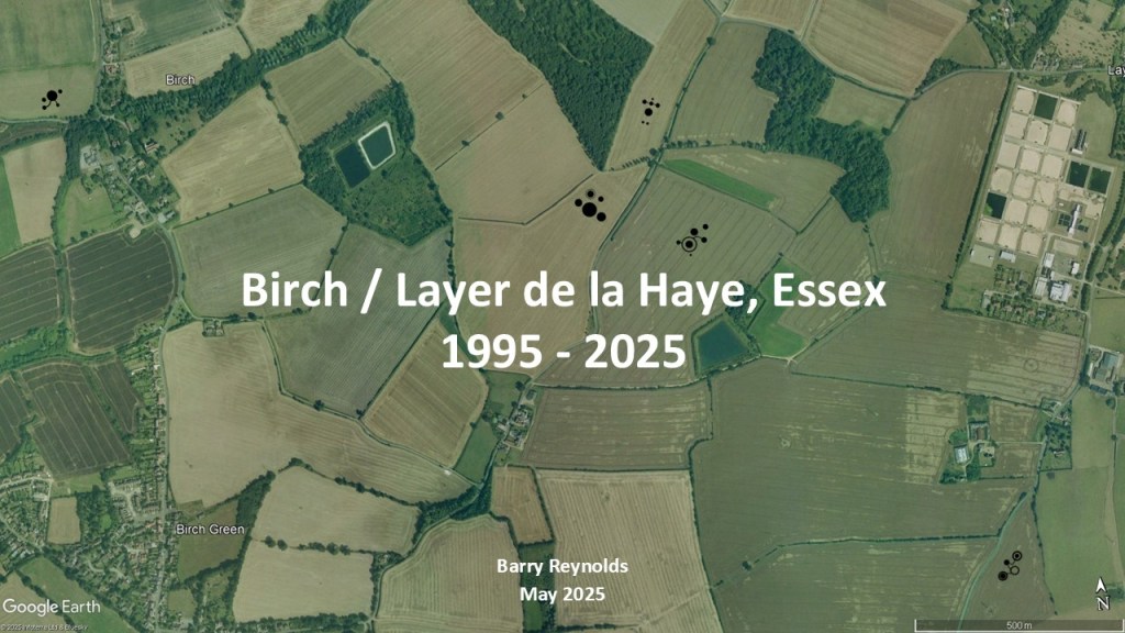
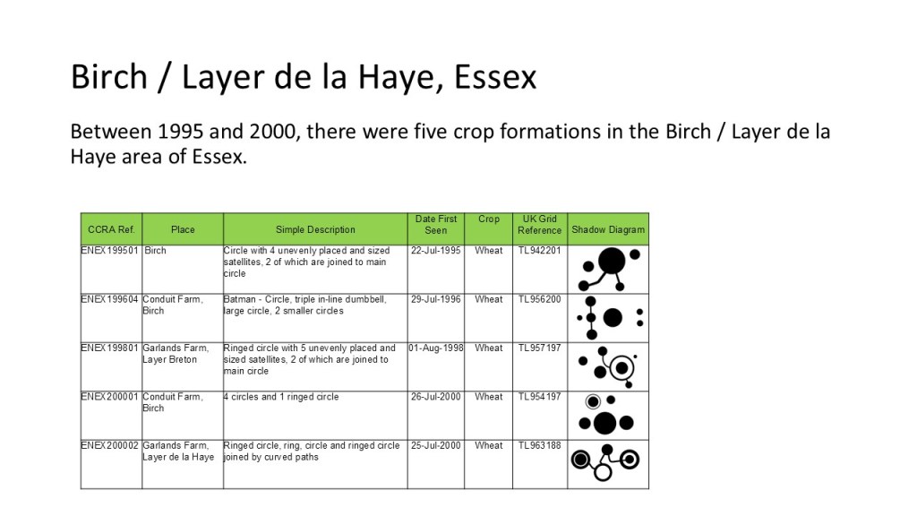
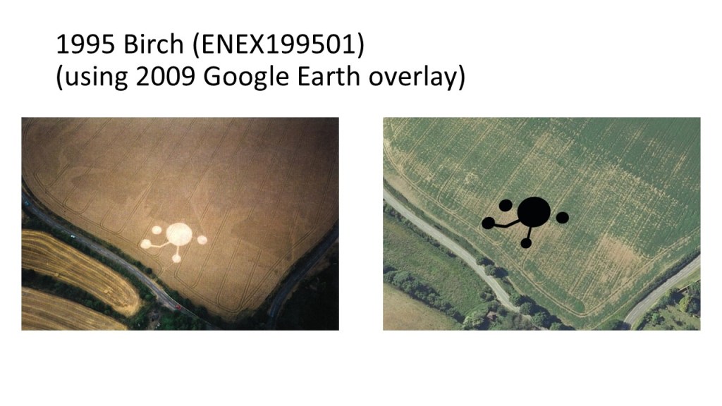
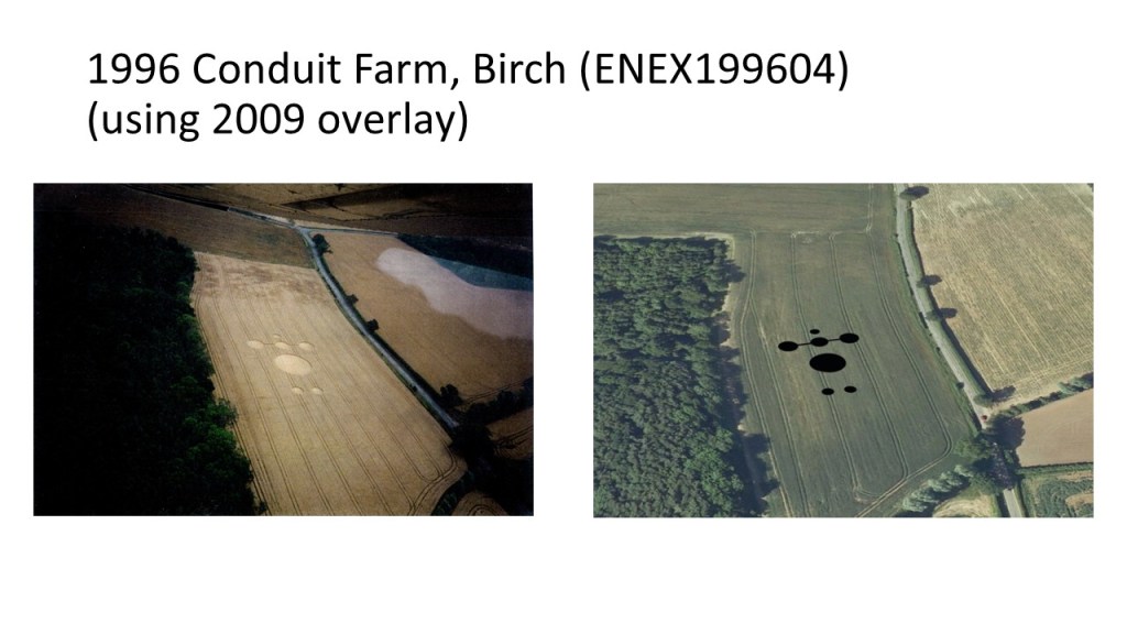
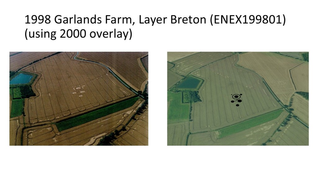
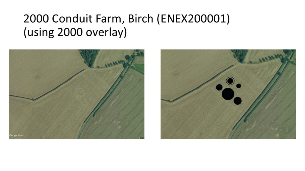
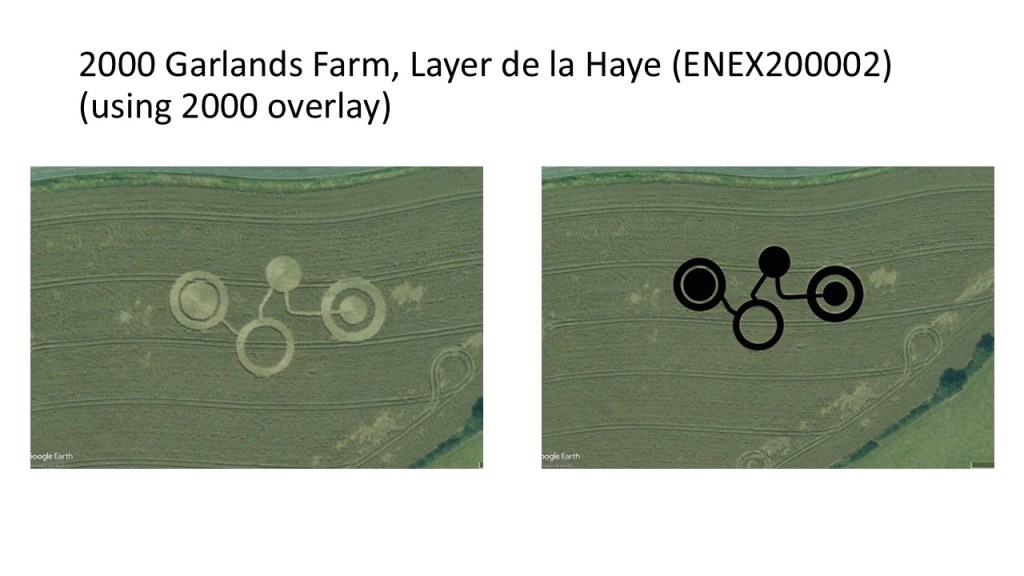
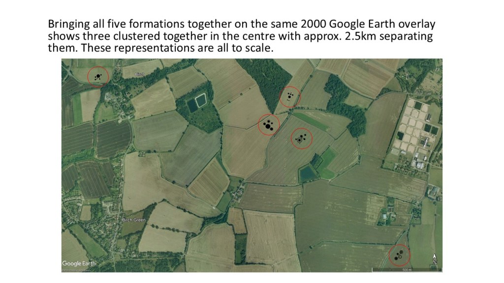
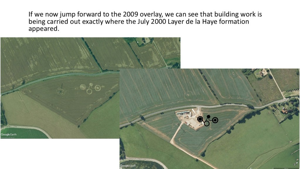
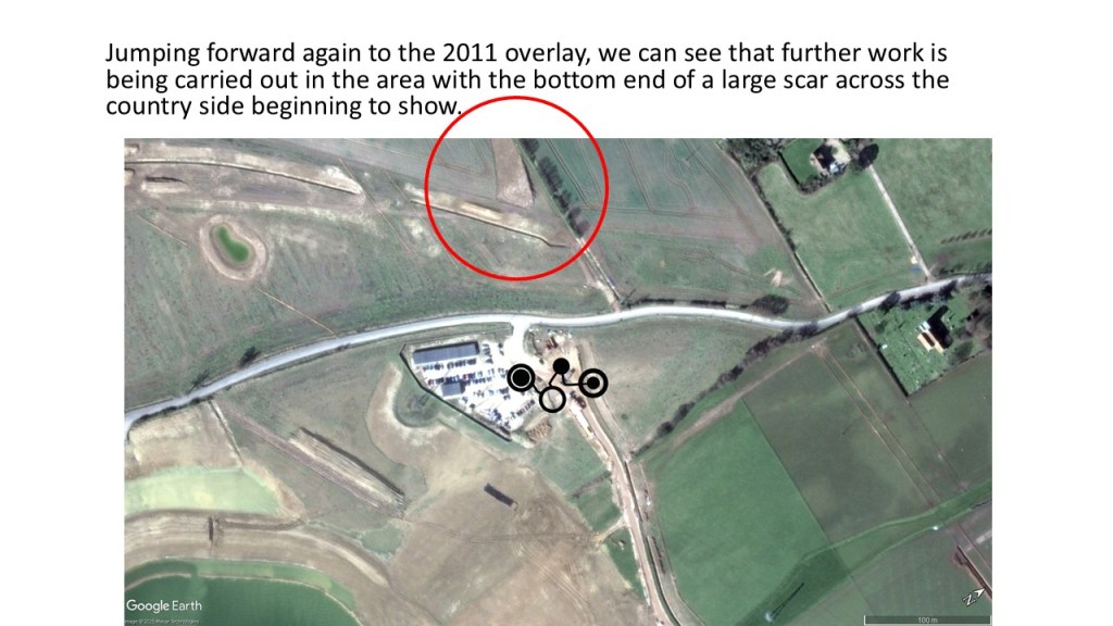
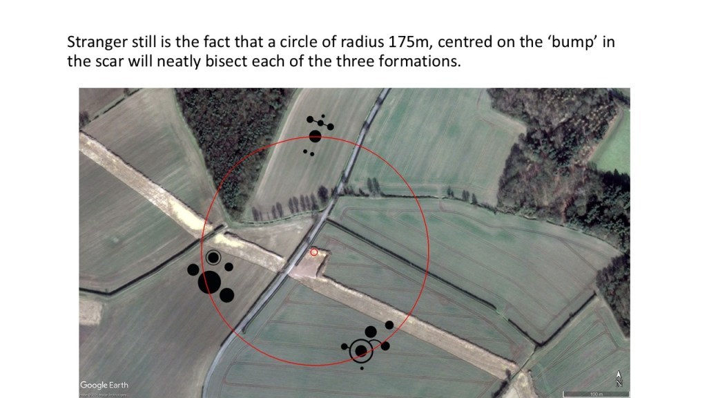
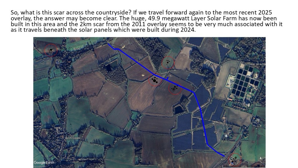
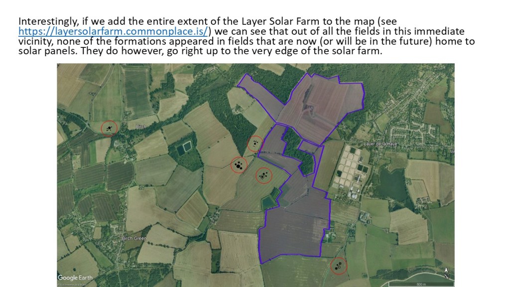
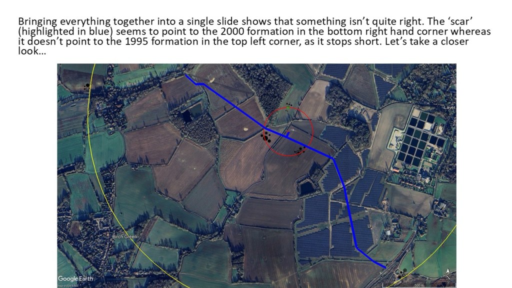
The presentation below shows what happened in the area around Birch / Layer de la Haye in Essex after five crop formations appeared between 1995 and 2000. Google Earth has been used extensively to ensure the formations are overlaid into the landscape as accurately as possible. Planning for the Layer Solar Farm had not begun at that time and the route of the underground cable had not been determined.

The Crop Circle Research Archive is home to one of the world’s largest databases of crop circle-related information.